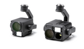
General
Weight
Zenmuse H20: 678±5 g
Zenmuse H20T: 828±5 g
Dimensions
Zenmuse H20: 150×114×151 mm
Zenmuse H20T: 167×135×161 mm
Ingress Protection Rating
IP44
Operating Temperature
-20° to 50° C (Temperature Measurement is only available between -10° to 50° C)
Storage Temperature
-20° to 60° C
Laser Safety
Class 1M (IEC 60825-1:2014)
Supported Aircraft
Matrice 300 RTK
Gimbal
Angular Vibration Range
±0.01°
Mount
Detachable
Controllable Range
Pitch: -120° to +30°
Yaw: ±320°
Mechanical Range
Pitch: -132.5° to +42.5°
Yaw: ±330°
Roll: -90° to +60°
Zoom Camera
Sensor
1/1.7" CMOS, 20 MP
Lens
DFOV: 66.6°-4°
Focal length: 6.83-119.94 mm (equivalent: 31.7-556.2 mm)
Aperture: f/2.8-f/11 (normal), f/1.6-f/11 (night scene)
Focus: 1 m to ∞ (wide), 8 m to ∞ (telephoto)
Focus Mode
MF/AF-C/AF-S
Exposure Mode
Auto, Manual
Exposure Compensation
±3.0 (1/3 increments)
Metering Mode
Spot metering, Center-weighted metering
AE LOCK
Supported
Electronic Shutter Speed
1 ~ 1/8000 s
ISO Range
Video: 100 - 25600
Photo: 100 - 25600
Video Resolution
3840x2160@30fps, 1920x1080@30fps
Video Format
MP4
Video subtitles
Supported
Photo Size
5184 × 3888
Photo Format
JPEG
Wide Camera
Sensor
1/2.3" CMOS, 12 MP
Lens
DFOV: 82.9°
Focal length: 4.5 mm (equivalent: 24 mm)
Aperture: f/2.8
Focus: 1 m to ∞
Exposure Mode
Auto
Exposure Compensation
±3.0 (1/3 increments)
Metering Mode
Spot metering, Center-weighted metering
AE LOCK
Supported
Shutter Speed
1 ~ 1/8000
ISO Range
Video: 100 - 25600
Photo: 100 - 25600
Video Resolution
1920×1080@30fps
Video Format
MP4
Video subtitles
Supported
Photo Size
4056 x 3040
Photo Format
JPEG
Thermal Camera (Zenmuse H20T)
Sensor
Uncooled VOx Microbolometer
Lens
DFOV: 40.6°
Focal length: 13.5 mm (equivalent: 58 mm)
Aperture: f/1.0
Focus: 5 m to ∞
Digital Zoom
1x, 2x, 4x, 8x
Video Resolution
640×512 @ 30 Hz
Video Format
MP4
Image Resolution
640×512
Image Format
R-JPEG (16 bit)
Pixel Pitch
12 μm
Spectral Band
8-14 μm
Sensitivity (NETD)
≤50 mK @ f/1.0
Temperature Measurement Method
Spot Meter, Area Measurement
Scene Range
-40 °C to 150 °C (High Gain)
-40 °C to 550 °C (Low Gain)
Temperature alert
Supported
FFC
Auto/ manual
Palette
White hot/Fulgurite/Iron Red/Hot Iron/Medical/Arctic/Rainbow 1/Rainbow 2/Tint/Black Hot
Laser Rangefinder
Wave length
905 nm
Measurement range
3-1200 m (to a vertical surface with ≥12m diameter and 20% reflection rate)
Measurement accuracy
± (0.2 m + D×0.15%)
D is the distance to a vertical surface
Features
Hybrid Optical Zoom
23×(DFOV:4°,EQV:556.2mm)
Max. Zoom
200×(DFOV:0.5°,EQV:4800mm)
One Click Capture
One click to save the video or picture of 3 cameras (zoom, wide and thermal camera) simultaneously
Point to Aim
Double click on the wide/thermal camera view, then the system will automatically move the gimbal to focus on the point of interest
High-Res Grid Photo
Frame an area of interest in wide camera view, and the zoom camera will automatically capture a set of 20 MP images of the area. These images are stored together with an overview image that can be viewed in greater detail.
Night Scene
Supported (zoom camera)
Timestamp
Including GPS, date, and time
Storage
Supported SD Card
MicroSD card (Max capacity: 128 GB, UHS-1 Speed Grade 3 required)
Supported File Systems
FAT32 (≤ 32 GB), exFAT (> 32 GB)
Recommended Micro SD Cards
TOSHIBA EXCERIA PRO 32GB micro SD HC II
SanDisk_Extreme PRO_32GB_3_A1_micro SD V30 HC I
TOSHIBA EXCERIA PRO 64GB micro SD XC II
SanDisk_Extreme PRO_64GB_3_A2_micro SD V30 XC I
SAMSUNG_EVO_128GB_micro SD 3 XC I
TOSHIBA EXCERIA M303E 32GB micro SD HC I
TOSHIBA EXCERIA M303E 64GB micro SD XC I
TOSHIBA EXCERIA M303E 64GB micro SD XC I
TOSHIBA EXCERIA M303 128GB micro SD XC I
SAMSUNG_EVO_64GB_micro SD 3 XC I